Will we see a White Christmas this year?
Written by Mary Wasson, Meteorologist
Last updated 12/18/2023, 3:53:06 PM
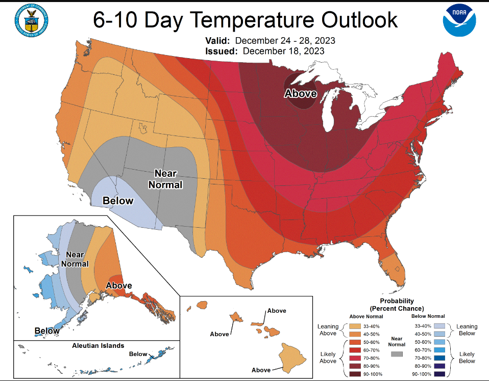
We will all be singing, “I’m Dreaming of a White Christmas” by Bing Crosby, this year and maybe changing the words to “I’m Dreaming of a Wet Christmas”. Most of the United States will see above-normal temperatures and wetter-than-normal conditions. The Pacific air streaming across the country right now will block any potential for intrusions of Arctic air or widespread snow events in the next several days.
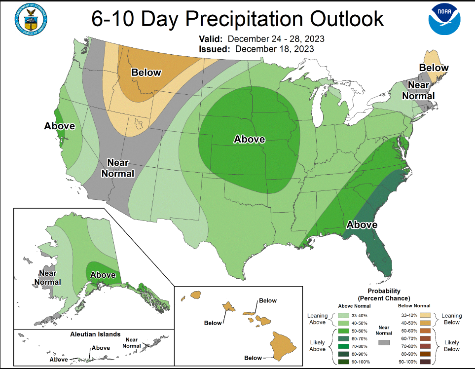
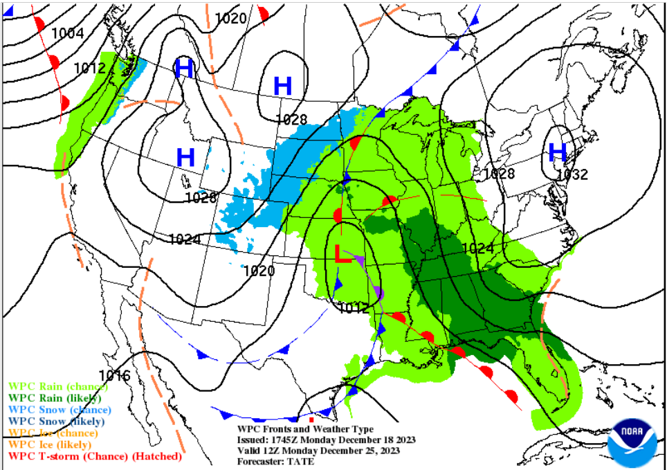
A large upper-level low on the West Coast will move onshore and track across the country later this week and into early next week. Rain is likely with warm temperatures ahead of the front. Christmas Day will be in the 60s and 70s extending from Texas, along the Gulf Coast, and into the Midwest.
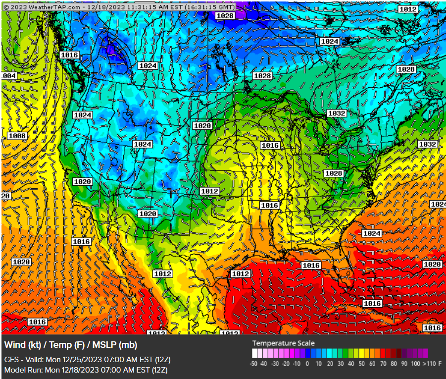
Behind the storm system, some cooler air will change the rain over to snow in the Rockies and Northern Plains as temperatures fall into the 30s.
What is the official definition of white Christmas?
According to the National Weather Service, a white Christmas is officially defined as having at least 1 inch of snow on the ground at 7 am local time Christmas Day.
On average, places like the Rockies, Sierra Nevada Mountains, Idaho, Minnesota, Maine, Upstate New York, the Allegheny Mountains of Pennsylvania, and West Virginia, have a higher probability of seeing a white Christmas.
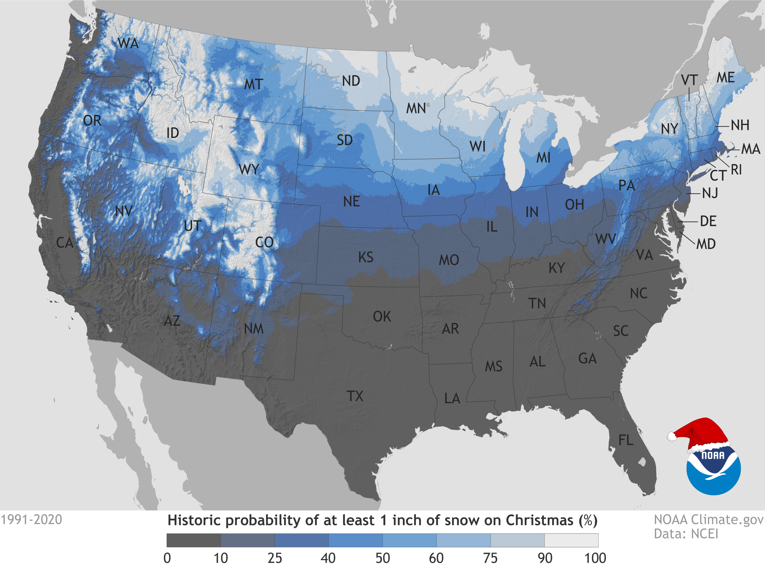
This map shows the historical probability of there being at least 1 inch of snow on the ground at weather stations across the United States on December 25 based on the latest (1991-2020).
On average, about 40% of the U.S. is typically snow-covered by Christmas, according to the National Oceanic and Atmospheric Administration (NOAA). However, this year, as of Dec. 15, only 18% is snow-covered, the lowest percentage for the date since 2006, according to the National Weather Service. This time last year, the nation was 42% snow-covered.
Why is this happening?
An independent group of scientists and communicators who research and report the facts about our changing climate and how it affects people's lives, Climate Central, says a warming climate is to blame.
They analyzed the Twelve Days of Christmas (December 25 to January 5) and noticed a warming trend since 1969. Using temperature data at 246 locations across the country, they found that 97% of stations have seen an increase in average temperature for these 12 days. Warming has exceeded 1°F for 94% of locations, 3°F for 75%, and 5°F for 37%.
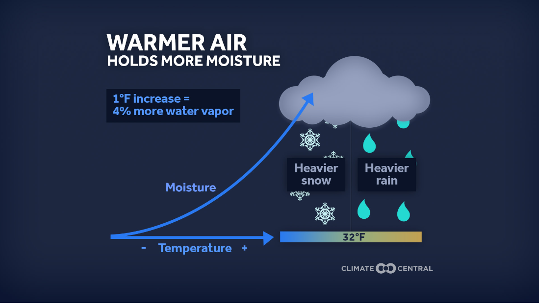
Winter has been the fastest-warming season for most of the U.S., increasing the likelihood of winter precipitation falling as rain rather than snow as warmer air can hold more moisture. But where that moisture falls mainly depends on local temperatures. Fewer freezes raise the odds of moisture falling as rain—not snow.
Whether you see snow on Christmas or a balmy 70 degrees, we hope you have a wonderful time with friends and family. Merry Christmas and Happy Holiday’s from WeatherTAP!