The National Hurricane Center's 'Cone of Uncertainty' will have a new look
Written by Meteorologist Mary Wasson
Last updated 7/23/2024, 9:37:07 AM
During hurricane season, the National Hurricane Center's most well-known graphic is the forecast cyclone cone. This year, it will be receiving its first major upgrade since it was introduced on July 14, 2002, for Tropical Storm Arthur. The goal is to better communicate the wide-ranging threats of tropical cyclones to the public well before they make landfall.
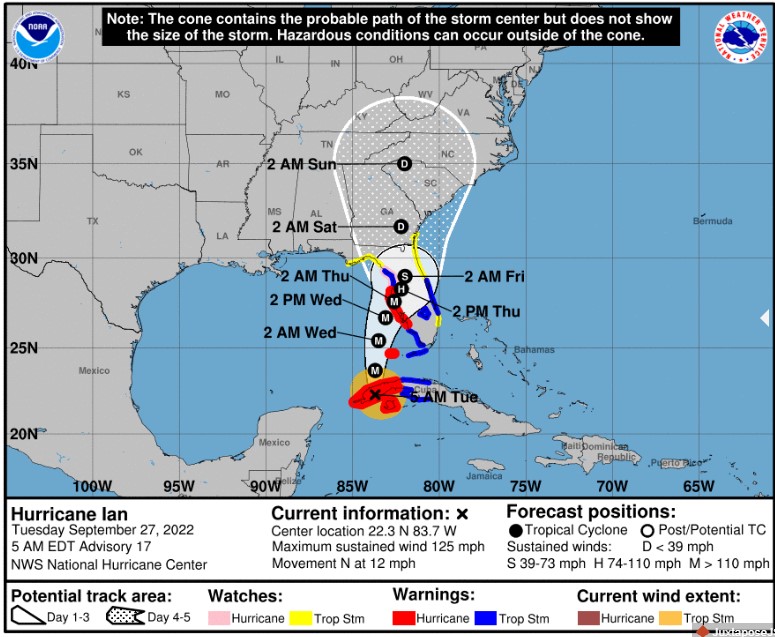
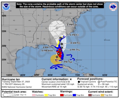
The current cone represents the probable track of the center of a tropical cyclone and is formed by a set of circles along the forecast track at 12, 24, 36, 48 hours, and so on.
The National Hurricane Center regularly updates its graphics and forecasts, but the changes are typically more noticeable in the details rather than in the overall display.
The NHC will introduce a modified version of the graphic for the 2024 hurricane season in the Atlantic and Eastern Pacific basins. This new version will still include the familiar forecast cone but will also incorporate color-coded tropical storm and hurricane warnings.
Foxweather.com reports that this year, forecast periods beyond hour 12 will have wider cones than last year. This adjustment takes into account errors that have occurred during previous hurricane seasons.
According to Foxweather.com, this year, every forecast period beyond hour 12 is wider than last year’s cone, which factors in accrued errors during past hurricane seasons.
“At 36 hours out, track cones will now be 4% larger, only about 2-3 miles different from last year. The most significant changes will be at hours 60 and 120, when the cone will be 9% and 7% wider, respectively,” Fox Weather said.
Starting around August 15, 2024, NHC will start issuing an experimental version of the cone graphic. This version will include inland tropical storm and hurricane watches and warnings for the continental United States. The purpose of adding inland watch and warning information on the cone graphic is to help people understand the risk of strong winds during tropical cyclone events. Recommendations from several social science research studies suggest that including inland watches and warnings will help prevent misinterpretation of the cone as an indication of one's risk of strong winds.
The new changes to the hurricane cones are expected to assist coastal and inland communities in better preparing for a tropical cyclone beyond the initial threat of winds, rain, and surges.