Fog Comes in Many Forms but is Always a Travel Headache
Written by Mary Wasson, Meteorologist
Last updated 11/28/2023, 7:53:01 PM
Foggy mornings are common across the United States at all times of year but especially in the fall and winter time. The nights are longer, which allows more time for the temperature to cool and reach the dew point, and that is needed for fog formation.
The National Oceanic and Atmospheric Association (NOAA) defines fog as water droplets suspended in the air at the Earth’s surface. Fog is a cloud that forms at ground level instead of in the sky. It comes in various forms and can have different impacts on visibility.
Fog can form in a variety of ways:
- lowering the temperature to the dew point
- adding enough moisture to raise the dew point
- mixing cold air with warm, moist air
What are the different types of fog?
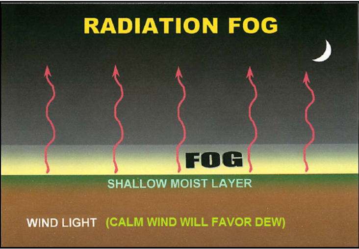
Radiation fog occurs as the air near the ground cools overnight under clear skies, which allows the air temperature to meet with the dew point. This reduces the air's ability to hold moisture, leading to condensation and fog formation. This fog typically starts near the surface, thickens as the air continues to cool, and extends upwards as the night progresses. This fog usually dissipates soon after sunrise as the ground warms up.
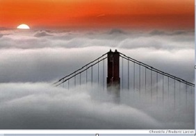
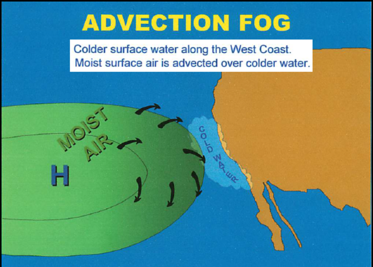
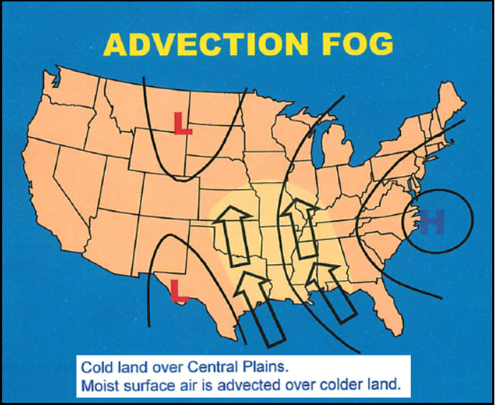
Advection fog is formed when warm, moist air flows over a cooler surface, causing the near-surface air to cool below its dew-point temperature. This type of fog is a common occurrence around the Golden Gate Bridge in San Francisco and along the Gulf of Mexico.
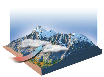
Upslope fog forms when sloping terrain lifts air, it expands and cools as it moves upward. This process is also referred to as adiabatic cooling. It typically forms at higher elevations and descends into valleys, often occurring on the eastern slopes of the Rocky Mountains.
Precipitation fog forms when rain falls through cold air. This is common with the passage of a front. The evaporation of water from falling raindrops can raise the dew point in the air beneath the cloud. If enough vapor is added to the air to saturate it, fog forms on the surface.
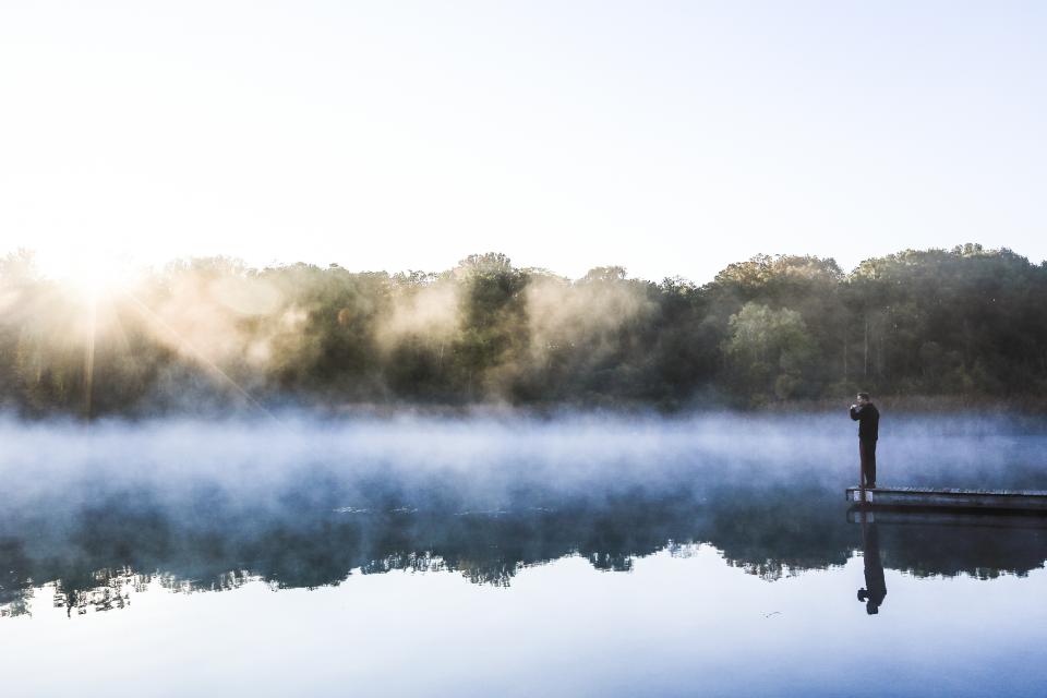
Steam fog is commonly seen on lakes and often occurs in the fall season. As summer ends, water temperatures do not cool as fast as the air temperature does. When cold air passes over a warm body of water, the air above the water mixes with the cold air, creating a layer of fog. This transport between the lake and air evens out. This corresponds to the second law of thermodynamics and this law states "any two bodies that come into contact, the system will become equilibrium state." Steam fog does not become very deep but enough to block some of the sunlight.
Freezing fog develops when the temperature falls at or below 32 degrees. This fog produces drizzle and these tiny droplets freeze when they come into contact with an object.
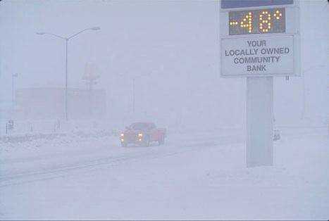
Ice fog is only seen in the polar and arctic regions when temperatures are at 14 degrees or below, and it is too cold for air to contain super-cooled water droplets, so it forms tiny ice crystals.
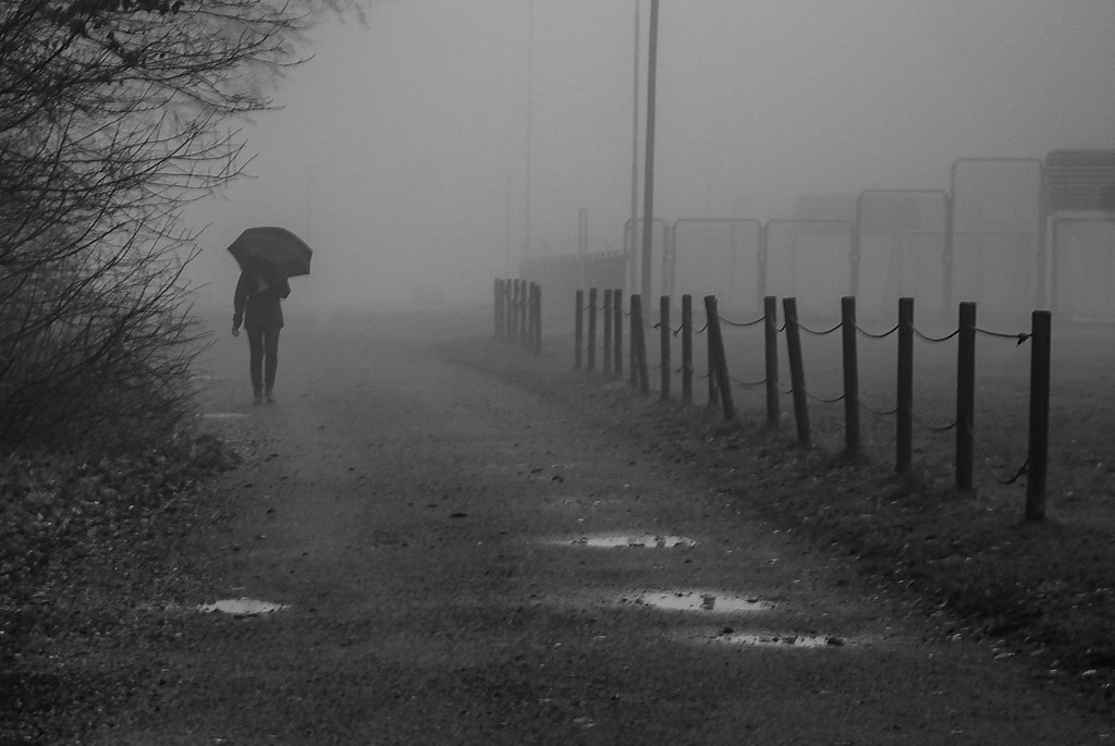
If the fog becomes severe, the National Weather Service issues a Dense Fog Advisory, which warns drivers of reduced visibility to ¼ mile or less over a large area for an extended period.
Recently, there have been reports of major traffic accidents along I-10 in New Orleans caused by super fog. The National Weather Service (NWS) explains that this type of fog forms when a mixture of smoke and moisture released from damp, smoldering organic materials such as brush, leaves, and trees mixes with cooler, saturated air. Under light wind conditions, it can move through low terrains and is extremely dangerous when it is present over highways, reducing visibility to less than 10 feet.
If you encounter dense fog on your commute, the best thing to do is to slow down, allow extra distance between your car and the cars in front of you, and always switch your headlights to low beams.